 |
Headquarters 74 High Street Billericay Essex CM12 9BS Affiliated to the Council for the Protection of Rural Essex |
|
|
|
ANNUAL GENERAL MEETING
Wednesday 19th March 2008
The Agenda and Minutes of last year's Annual General Meeting are attached to this Newsletter.
Positions on the Committee that become vacant at the AGM are those of: Chairman, Vice Chairman, Hon. Secretary, Hon Treasurer and Hon Membership Secretary. The Committee comprises these officers together with six other members elected at the AGM and the President and life Vice-Presidents.
If there is anyone amongst our members who feels he/she would like to put their name forward to become an officer of The Society, please forward your name to our Headquarters at 74 High Street Billericay, or come along to the Annual General Meeting and offer your services.
CHAIRMAN’S REPORT
On behalf of your committee, I wish all of our members
a healthy and successful new year in 2008 and a speedy recovery to those
who are ill. As we look forward to the New Year you have the opportunity
to fulfil that ambition to volunteer to serve on the committee.
I am pleased to announce that for the next year your present committee
has agreed to stand for re-election at the AGM. I am most grateful for
their continued support of the Society and their cheerful involvement
in community affairs. However, some members have indicated that this
will be their last year on the committee.
The Society aims to protect the Green Belt land and our local footpaths.
It also arranges social evenings and provides a ‘watch dog’
role to maintain the character of Billericay. If you wish to help in
all that the Society affords then please encourage your friends or acquaintances
to join the society.
Developers love an apathetic community. We have some attractive open
spaces for them to make a large profit out of with no regard for our
environment and quality of life. So encourage dog walkers and those
who enjoy our country park areas and footpaths to volunteer.
We have to wait to gain access to the Day Centre. The delay is caused
by an ‘activity booking’ immediately before ours and they
require extra time to leave the hall. So we have been asked to give
them space for their departure. Basildon Council needs to obtain more
bookings for the Day Centre to keep it a viable community centre. Please,
be patient and understanding if there is a delay in our getting access
to the hall.
Exhibition
In an attempt to encourage younger members to join the Society the committee
is organising an Exhibition in the Reading Rooms at 73 High Street on
the morning of 19th April 2008. Please make a note in your diary and
tell your friends to attend and appreciate what the Society does.
Review of 2007
As you sit back and look forward with hope to what 2008 will bring,
apart from increased energy prices and political unrest, you can contemplate
2007.
Our main strength was the continued existence of the Society into its
72nd year of service to the community. The Society founded in July 1935,
to stop the wholesale demolition of our old timber framed buildings
and replace them with boring buildings lacking any architectural merit.
This would have made Billericay just another clone town, as are so many
towns today; with the same square unimaginative blocks of shops.
ECC Highways Department responded to our request for a public display
and an opportunity to comment on its plans for the southern area of
the High Street, and Sun Street. They have been listening to the wishes
of the senior residents of Sun Street. We just need to have the pedestrian
crossing sited in a better location in Sun Street.
Our members answered several consultations regarding parking in the
area of Laindon Road and around the green open space land at Sun Corner.
Billericay Town Council; with supporting evidence supplied by the Society
from our scrapbook collection; has submitted a planning application
for the Sun Corner open space to be recognised and registered as common
land.
The Society successfully campaigned to stop developers building on this
open space land at Sun Corner in September 1980.
The Society also successfully campaigned against the over development
of land around Norsey Wood. The Society spent some 30 years getting
a conservation order on Norsey Wood. Without these activities of the
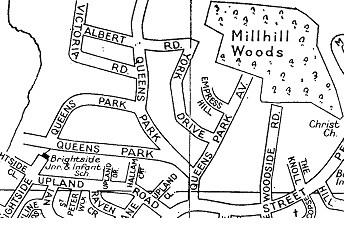
Society, we may not now be enjoying the benefits of Mill Meadows and
Queens Park Country Park. These are aspects worthy of some serious consideration.
John Baron, our local MP addressed the Society on the 19th September.
This was the first such occasion for the Society. He spoke on relevant
local issues and encouraged our efforts to protect the Green Belt land
around Billericay. John Baron also supported a campaign, started by
Society member and Town Councillor Terence Gandy and backed by the Society,
to save the St Andrew’s Health Centre facility. This I feel will
be an ongoing campaign for several years.
Another ongoing activity with which the Society has been involved and
seconded onto the Town Council’s War Memorial Working Group is
the question of the trees at the War Memorial and the clarity if the
inscribed names on the memorial plaques.
There used to be seven trees in ‘the triangle’, as the site
is referred to on old plans. This is evident from pre-World War I photographs.
The presence of lichen on some of the plaques is due to the clean air
as provided by the trees. That is despite the triangle being on a busy
road junction. Lichen, are very fussy about where they grow. Trees help
to clean the air by absorbing carbon dioxide and releasing oxygen into
the air. These are two very good reasons to keep these trees.
The problem with legibility of the names on the memorial is vexing.
It is an historic site and cannot be pulled it down and rebuilt. The
World War II memorial was built with funds raised locally at a time
of great austerity in the UK to honour those who fell. To reduce costs
a reconstituted stone was used for the capstone; natural stone being
too expensive.
The chair of the War Memorial Working Group is a member of the Society
for the Protection of Ancient Buildings, SPAB. He is most anxious to
preserve the integrity of this monument.
If the names were to be re-cut the letters would be too close together
and it would cause even greater deterioration to them due to weathering.
To removing the lichen controlled experiments with modern chemical masonry
cleaners have been conducted to highlight the letters. It is imperative
that the names remain intact, and not damaged by hasty detrimental action.
The Town Council are doing their best to do the right thing.
Kate Gilbert has been in contact with ECC to try to get more trees planted
in the High Street. She has succeeded in getting four new trees planted
this year, well done Kate.
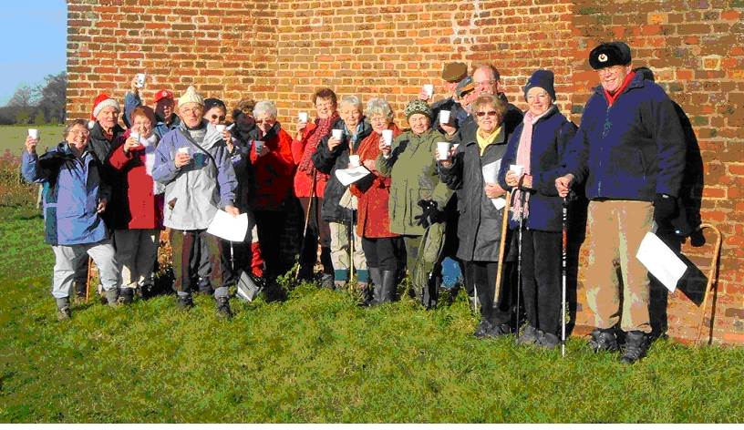
On a bright sunny Sunday in August on behalf of the Society I led some
60 people on my second town walk. From the station the route taken was
around the Workhouse site, Grey Ladies Place and up to the High Street.
I have proposed to the Town Council, who sponsor the refreshments and
provide the loud hailer, that should significant numbers attend in future
we split the group and have two guides on duty.
The Society has sponsored a Town Walk map for the new town notice board,
at the junction of Stock Road and Western Road. Bennett’s Funeral
Directors are sponsoring this new notice board for the display of BTC
notices.
To appreciate the countryside and the historical buildings encountered
the President of the Society organises fortnightly walks. You would
be surprised what views are behind some of our hedgerows.
Marian Thilo continues to provide interesting speakers for the Wednesday
social evenings, the average attendance being about sixty.
On behalf of the Society Roy Mizen, our vice-president, has been appointed
a consultant to the ECC for the Local Core Strategy Planning.
Did you notice in the local Weekly News that my six improvement suggestions
in the August 2007 Newsletter made the headlines. We manage to get regular
mentions in the local newspapers for our involvement in local activities.
This publicity has encouraged a number of new members in 2007 and maintains
our membership level.

Ian Fuller laying a wreath on behalf of the Society at the Remembrance Day ceremony.
David Bremner
Chairman